Is it worth it?
Who El Boquerón is for
This is the easy volcano option. There is no summit hike and no long transfer, just a drive up from the city, a short walk, and a view into a very large hole in the ground. That makes it a good fit for an arrival or departure day near San Salvador, for travelers who don't want the longer Santa Ana climb, and for anyone who simply wants to see a crater without making a whole expedition of it.
The honest limitation is the weather. Clouds can sit on the top of the volcano and hide the crater completely, so give yourself a morning rather than a fixed hour, and don't make it the only thing you came to see.
At the top
What you see from the rim
The park is Parque Nacional El Boquerón, a protected area at about 1,950 meters, run by CORSATUR, the national tourism corporation. It has an interpretive center, footpaths, viewpoints, visitor toilets, and parking.
The marked trail leads to three viewpoints, each at a different angle over the crater. From them you can see El Boqueroncito, a small cone inside the main crater (El Salvador Travel puts it at about 37 meters tall), and the slopes where farmers grow flowers and temperate fruit. CORSATUR also mentions exotic flower crops on the summit, wildflowers, cypresses, and pines.
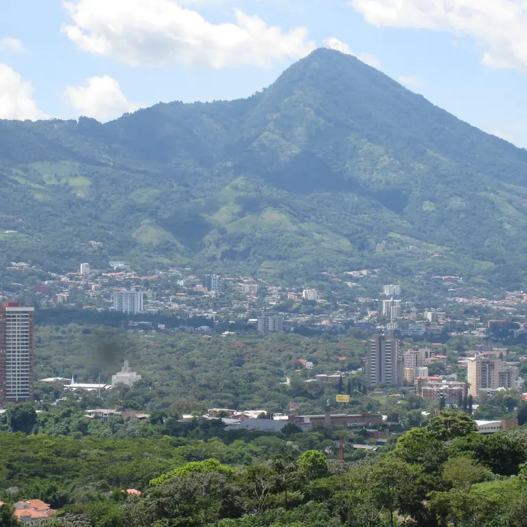
Look outward as well as down. CORSATUR promises its most spectacular view of San Salvador, and with good visibility you can pick out Lake Ilopango.
How long is the walk?
El Salvador Travel describes a walk of about 20 to 25 minutes to the crater on signposted trails. That is a stroll by volcano standards, but it is still an outdoor path at altitude, so wear closed shoes and take your time on the way back up.
Cool air and clouds
CORSATUR gives daytime temperatures of roughly 18 to 22°C at the top, falling to around 8 to 12°C at night. Bring a light layer even if the city below feels hot, go early for the best chance of a clear crater, and check the MARN forecast before you set off.
A bit of history
Why there is a small cone inside the crater
Boquerón means "big mouth" in Spanish, which is fair for a crater about 1.5 kilometers across and roughly 500 meters deep. Until 1917 it held a lake. On 7 June that year, two strong earthquakes struck San Salvador in the evening, and shortly afterward fissures opened on the volcano's northwest flank. Within about a month the crater lake had evaporated, and the eruption left behind the little cinder cone now called Boqueroncito.
The same northwest fissure zone has a longer story. The Loma Caldera eruption that buried the ancient village at Joya de Cerén came from it, which makes the two places a satisfying pair for one day.
Getting there
How to plan the drive up
The park sits on the upper slopes above the capital, in the area El Salvador Travel lists under both San Salvador and La Libertad. The simplest plan is a private driver, a taxi arranged through your hotel, or a rideshare from San Salvador or Santa Tecla. Agree on the return before you go up.
On the road up
Coffee, lunch, and viewpoints
Part of the pleasure is the road itself. El Salvador Travel notes viewpoints, restaurants, and cafés along the way with views over San Salvador, Lake Ilopango, and the Chinchontepec volcano. You'll find coffee, fresh fruit drinks, and plenty of places for a long lunch, so it is easy to turn a short walk into a relaxed half day.
Pair it
What fits around El Boquerón
- San Salvador's museums and historic center, for a city day with one volcano view.
- Joya de Cerén, for the archaeology that the volcano's own history helps explain.
- A first or last night near the airport, when you want one easy outing rather than a long transfer.
- The Santa Ana volcano another day, if El Boquerón leaves you wanting a proper summit hike.
Official checks · reviewed 12 October 2026
Check the park and the weather before you go
El Boquerón reopened on 16 July 2026 after a period of maintenance work, and the tourism ministry said more phases were being built. Opening details can change, so check CORSATUR or El Salvador Travel shortly before your visit, and look at the MARN forecast on the morning.
Related guides